File:Roanoke NASA World Wind.jpg
Jump to navigation
Jump to search

Size of this preview: 800 × 592 pixels. Other resolutions: 320 × 237 pixels | 640 × 474 pixels | 1,024 × 758 pixels | 1,280 × 948 pixels | 1,383 × 1,024 pixels.
Original file (1,383 × 1,024 pixels, file size: 1.26 MB, MIME type: image/jpeg)
Summary
| Description |
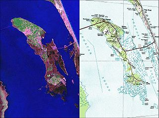
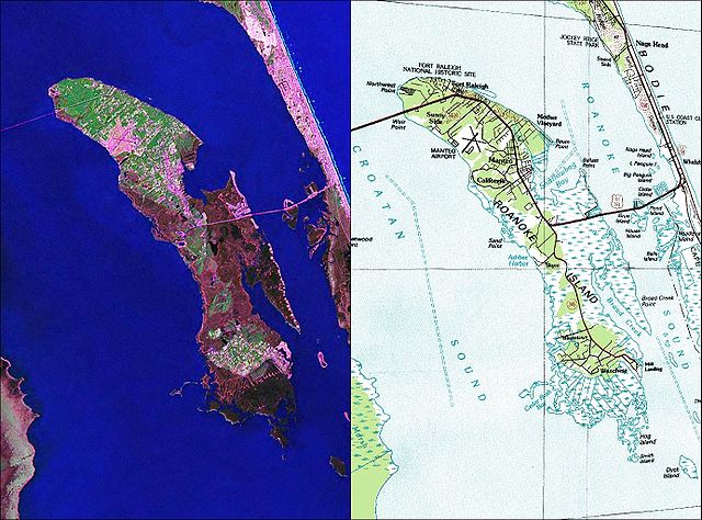
English: NASA World Wind Geocover 2000 and topographic map coverage of Roanoke Island, North Carolina |
| Date | 2000s |
| Source | NASA World Wind Screen Shot |
| Author | NASA |
Licensing
This image is in the public domain in the United States because it only contains materials that originally came from the United States Geological Survey, an agency of the United States Department of the Interior. For more information, see the official USGS copyright policy.
|
File history
Click on a date/time to view the file as it appeared at that time.
| Date/Time | Thumbnail | Dimensions | User | Comment | |
|---|---|---|---|---|---|
| current | 12:35, 26 May 2010 | | 1,383 × 1,024 (1.26 MB) | Ratzer | {{Information |Description={{en|1=NASA World Wind Geocover 2000 and topographic map coverage of Roanoke Island, North Carolina}} |Source=NASA World Wind Screen Shot |Author=NASA |Date=2000s |Permission= |other_versions= }} [[Category:Maps of North Caroli |
File usage
The following page uses this file:
Global file usage
The following other wikis use this file:
- Usage on ca.wikipedia.org
- Usage on ceb.wikipedia.org
- Usage on de.wikipedia.org
- Usage on en.wikipedia.org
- Usage on eo.wikipedia.org
- Usage on es.wikipedia.org
- Usage on hu.wikipedia.org
- Usage on id.wikipedia.org
- Usage on ja.wikipedia.org
- Usage on ko.wikipedia.org
- Usage on nl.wikipedia.org
- Usage on pl.wikipedia.org
- Usage on pt.wikipedia.org
- Usage on ru.wikipedia.org
- Usage on zh.wikipedia.org