Shortcut: wd:WDQS/Result viewsויקינתונים:שירות תשאול SPARQL/עזרה בשאילתות ויקינתונים/תצוגות תוצאות

הדף הזה יסייע לך להבין את מגוון האפשרויות להצגת תוצאות בשירות התשאול ב־SPARQL. דף התשאול לדוגמה מכיל המון דוגמאות טובות שאפשר לנסות!
לאחר הרצת שאילתה, אפשר לבחור באמצעות כפתור ה„תצוגה” איזו תצוגת תוצאות תופיע. בהתאם לשאילתה שלך ולסוג הנתונים, חלק מהתצוגות תהיינה זמינות.
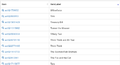
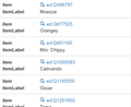
טבלה (ברירת מחדל)
מציג את התוצאות כטבלה. זאת תצוגת ברירת המחדל לתוצאות והיא יכולה להציג כל סוג של נתונים.
תמפה כל משתנה מפסוקית הבחירה (select) של SPARQL לעמודה מסודרת בטבלה.
-
 טבלת תוצאות
 -
 טבלת תוצאות במסכים קטנים עם עמודות הפוכות.


רשת תמונות

מציג את נתוני התוצאות כרשת עם תמונות.
לכל פריט ברשת יש תמונה גדולה והגלריה נפתחת בלחיצה עליו.
תוכן של פריט הוא נתוני שורה מסודרים
| משתנה | סוג נתונים | מיפוי | תיאור |
|---|---|---|---|
| * | מדיה של ויקישיתוף | פריט ברשת | עמודות תונות תיצורנה פריט ברשת. |
שורות שלא מכילות תמונות לא תופענה.
אפשר, למרות זאת, לכלול שורות ללא תמונות בתוצאות על ידי שינוי ה־SPARQL כך שיכלול תמונת ברירת מחדל אם משתנה התמונה לא תחום:
  optional {
    ?item wdt:P18 ?img_ .
  }
  bind (if(bound(?img_),
           ?img_,
           <http://commons.wikimedia.org/wiki/Special:FilePath/File:Profile_avatar_placeholder_large.png>) as ?image) # [[:commons:File:Profile_avatar_placeholder_large.png]] as a placeholder
כאן הקובץ commons:File:Profile avatar placeholder large.png משמש כממלא מקום, אפשר להשתמש גם במשהו משלך
דוגמה לשאילתה שלמה שמשתמשת בטכניקה הזאת.
אפשרויות
| שם האפשרות | סוג | תיאור |
|---|---|---|
hide
|
שם משתנה אחד או יותר (מחרוזות, שמתחילות ב־ ?), ערך בודד או מערך
|
לא להציג את המשתנים האלה בתוצאה. |
מפה
מציג את התוצאות כמפה עם הנתונים של Open Street Map.
| משתנה | סוג נתונים | מיפוי | תיאור |
|---|---|---|---|
| * | נקודת ציון או צורה גאוגרפית | סמן במפה | עמודות תיצורנה סמן על המפה.
תוכן הסמן הוא נתוני השורה המסודרים. |
| ?layer | שכבת סמני מפה | יוצר שכבת מפה צבעונית שמאפשרת סינון. | |
| ?rgb | צבע | סמן מפת צבעים | למשל 000000 לצבע השחור. |


Technically, any well-known text literal can be displayed, not just a point coordinate.
Non-point geometry values are never stored on Wikidata, but they can be constructed in SPARQL using functions like CONCAT() and STRDT() –
see this map of Czech railway lines for an example of LINESTRING() geometry.
אפשרויות
specify using e.g. #defaultView:Map{"hide":["?foo", "?bar"],"layer":"?bar"}, using an array when there are multiple variables.
| שם האפשרות | סוג | תיאור |
|---|---|---|
hide
|
One or more variable names (strings, starting with ?), single value or array
|
לא להציג את המשתנים האלו בתוצאה. |
layer
|
One or more variable names (strings, starting with ?), single value or array
|
Use these variables for the map layer, instead of the default ?layerLabel, ?layer.
|
markercluster
|
בוליאני או עצם |
|
Line, Bar, Scatter and Area Chart
מציג את אחד מסוגי התרשימים האלה.
| משתנה | סוג נתונים | מיפוי | תיאור |
|---|---|---|---|
| * | מספר
תווית תאריך ושעה |
ציר X
ציר Y |
הראשון יהיה ציר X, השני ציר Y |
| * | תווית | פריט בקטגוריה / מקרא (רשות) | ישמש רק לאחר שאלו שלעיל מופו |
| * | תווית | Storyboard / Animation (optional) | ישמש רק לאחר שאלו שלעיל מופו |


תרשים בועות

מציג תרשים בועות בו הגודל והצבע של הבועה נתון להגדרה.
כאשר מסופק פריט בועה מקושרת ל־Wikidata.org.
| משתנה | סוג נתונים | מיפוי |
|---|---|---|
| * | תווית | תווית בועה |
| * | מספר | גודל בועה |
| * | פריט | קישור בועה (רשות) |
| ?rgb | צבע | צבע בועה (רשות) |
מפת עץ

מציג מפת עץ עם אפשרות תקריב.
| משתנה | סוג נתונים | מיפוי | תיאור |
|---|---|---|---|
| * | תווית | תווית | תווית ראשונה בשורה תהיה הרמה הראשונה במפת העץ.
התווית השנייה תהיה הרמה השנייה. התווית השלישית תהיה הרמה השלישית וכו׳. |
| * | פריט | קישור (רשות) | |
| * | כמות | גודל |
עץ
מציג עץ מתרחב.

| משתנה | סוג נתונים | מיפוי | תיאור |
|---|---|---|---|
| * | פריט | מזהה מפרק | הפריט הראשון יהיה מפרק השורש שהפריטים הבאים מאותה השורה יחוברו תחתיו. |
| * | תווית | תווית המפרק (רשות) | תתווספנה תוויות למפרק הנוכחי. |
| * | מספר | תווית המפרק (רשות) | |
| * | מדיה של ויקישיתוף | תמונת פריט |
ציר זמן

מציג ציר זמן שניתן לחקור.
| משתנה | סוג נתונים | מיפוי | תיאור |
|---|---|---|---|
| * | תאריך ושעה | פריט נקודה בזמן
פריט סיום נקודה בזמן |
תאריך ראשון בשורה מגדיר את מיקום הפריט בציר הזמן.
אם קיים תאריך שני יוגדרו תאריכי התחלה וסיום. |
| * | מדיה של ויקישיתוף | תמונת פריט |
אפשרויות
| שם האפשרות | סוג | תיאור |
|---|---|---|
hide
|
שם של משתנה אחד או יותר (מחרוזות, מתחילות ב־?), ערך או מערך בודד
|
לא להציג את המשתנים האלה בתוצאה. |
ממדים

הצגת ממדים ואת הקישורים שלהם.
מאפשר גם לסנן אותם על ידי בחירת חלק מציר.
סוג התרשים הזה ידוע בתור parallel coordinates.
| משתנה | סוג נתונים | מיפוי | תיאור |
|---|---|---|---|
| * | תווית | ממד | כל עמודה בשורת התוצאה ממופה לממד |
| * | מספר | ||
| * | תאריך ושעה |
תרשים
הצגת תרשים אינטראקטיבי שמציג סדר היררכי ופריטים לחקירה.
| משתנה | סוג נתונים | מיפוי | תיאור |
|---|---|---|---|
| * | פריט | מזהה מפרק | לפריט הראשון בשורה יהיה חץ שמצביע על הפריטים באותה השורה |
| * | תווית | תווית המפרק (רשות) | |
| * | מדיה של ויקישיתוף | תווית המפרק (רשות) | |
| ?rgb | צבע | צבע המפרק (רשות) | למשל 000000 לצבע שחור. |
| * | מספר | גודל המפרק (רשות) | |
| ?edgeLabel | תווית | תווית הקצה (רשות) |

מידע נוסף
מיפוי סוג נתוני RDF
| סוג RDF | סוג נתוני RDF | אילוץ | סוג נתונים |
|---|---|---|---|
| URI | המחרוזת מתחילה ב־ http://www.wikidata.org/entity/Q |
Entity | |
| URI | המחרוזת מתחילה ב־ http://commons.wikimedia.org/wiki/Special:FilePath |
מדיה בוויקישיתוף | |
| Literal | http://www.w3.org/2001/XMLSchema#dateTime | DateTime | |
| Literal | http://www.opengis.net/ont/geosparql#wktLiteral | Coordinate | |
| Literal | http://www.w3.org/2001/XMLSchema#double
http://www.w3.org/2001/XMLSchema#float http://www.w3.org/2001/XMLSchema#decimal http://www.w3.org/2001/XMLSchema#integer http://www.w3.org/2001/XMLSchema#long http://www.w3.org/2001/XMLSchema#int http://www.w3.org/2001/XMLSchema#short http://www.w3.org/2001/XMLSchema#nonNegativeInteger http://www.w3.org/2001/XMLSchema#positiveInteger http://www.w3.org/2001/XMLSchema#unsignedLong http://www.w3.org/2001/XMLSchema#unsignedInt http://www.w3.org/2001/XMLSchema#unsignedShort http://www.w3.org/2001/XMLSchema#nonPositiveInteger http://www.w3.org/2001/XMLSchema#negativeInteger |
מספר | |
| Literal | אין סוג נתוני RDF | תווית | |
| Literal | יש מאפיין xml:lang |
תווית | |
| Literal | המחרוזת תואמת ל־ /^[0-9A-F]{6}$/ |
צבע |
עיצוב
יש עיצוב מיוחד לסוגי הנתונים הבאים:
| סוג נתונים | עיצוב |
|---|---|
| Entity | קישור ל־Wikidata.org
התווית מוקצרת ל־wd:Qxx חקירת פריט (סמל זכוכית מגדלת) |
| DateTime | MM DD, YYYY
Tooltip shows raw ISO timestamp |
| Commons Media | Link to Commons.Wikimedia.org
Displaying Gallery ( image icon ) |
Mobile / Responsive
Result views are made to work on different devices and resolutions. Their appearance may change depending on the space they can use.
Embed Mode
Result views can be linked or embedded via iframes. You can get the regarding link or code by clicking Link in the above menu.
See the difference: link to a query and link to a result or the embed code:
<iframe style="width:80vw; height:50vh;" scrolling="yes" frameborder="0" src="http://tinyurl.com/zwf4k2w">
Download results

There are several ways to export the results of a query.
JSON, TSV and CSV are three different open-standard formats to download the data, offered under the Download tab. To get results in XML format, click on Link > SPARQL endpoint.
You can also download some of the graphic views as a SVG file: this feature works with all the views except table, image grid, timeline, graph builder, map, and graph.
Default View
The default view can be change for each SPARQL query by using a comment:
#defaultView:[NAME]
For example:
#defaultView:ImageGrid
Result view options
Result views can be configured with various options, which are specified in JSON (Q2063) format,
either following the defaultView comment (see previous section)
or following a separate view comment.
#defaultView:Map{"layer": "?typeLabel"}
#view:ImageGrid{"hide": "?coords"}
Title
Result views can show a title. The title can be set via a title comment.
#title:A title of your choice
Auto language
When using the magic keyword [AUTO_LANGUAGE] it is replaced by the users language when submitting the query. This allows writing a query with where the result is displayed in the users language.
Example:
#<span lang="en" dir="ltr" class="mw-content-ltr">Use language of the user for display labels and fallback to english as default</span>
SERVICE wikibase:label {
    bd:serviceParam wikibase:language "[AUTO_LANGUAGE],en" .
}
Auto coordinates
When using the magic keyword [AUTO_COORDINATES] it is replaced by the users location when submitting the query. This allows writing a query with the users' location.
Example:
  SERVICE wikibase:around {
    ?place wdt:P625 ?coordinate_location.
    bd:serviceParam wikibase:center "[AUTO_COORDINATES]".
    bd:serviceParam wikibase:radius "1".
    bd:serviceParam wikibase:distance ?dist.
  }